
In 1983 and 1984, the United States Army Corps of Engineers (USACE) constructed improvements on what had previously been smaller levees along the lower Provo River and Utah Lake as an emergency measure to mitigate historic flooding along the Provo River and Utah Lake. Currently, those levees are shown providing 1%-annual-chance flood protection to approximately four square miles of Provo west of I-15, including the Provo Airport. The FEMA Flood Insurance Rate Maps (FIRMs) for the area are to be updated and will no longer show base flood protection by the levees due to a lack of required documentation for levee certification. FEMA’s action could add hundreds of existing residential, civic and commercial structures to the FEMA floodplain.
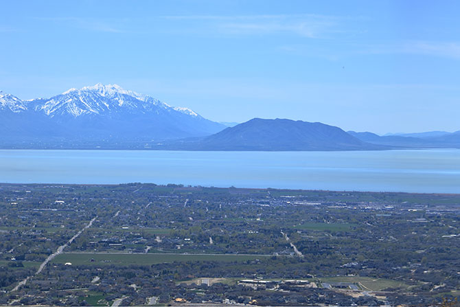
The Provo Levee system consists of lakeside and riverside levees. The Lakeside Levee is five and a half miles in length and acts as a flood protection barrier to Utah Lake and Provo Bay waters. The Provo River Levee system follows along the north and south sides of the Provo River from I-15 to Lakeshore Drive and provides flood protection to residential areas adjacent to the river.
Provo City and a team of CRS Engineers partnered to study the levees and to develop plan alternatives for Provo’s City Council to consider. Our report documented the existing conditions of the levees, presented alternatives for rehabilitating the levees for accreditation and created recommendations for moving forward with a preferred alternative.
The project team performed an assessment of the existing levees to evaluate whether the levee system meets the requirements of 44 CFR §65.10 — Mapping of Areas Protected by Levee Systems and to document any deficiencies that exist. Deficiencies in Freeboard, Closures, Embankment Protection and Stability, Interior Drainage, Vegetation Management and Right-of-Way Encroachment were identified for both the riverside and lakeside levees that render the levees not certifiable in their current state. Since the levees are not certifiable in their present condition, a rehabilitation project would be necessary to change the FEMA floodplain mapping and insurance requirements for the west part of the city.
Many levee embankment options were considered, including sheet piles, secant piles, cutoff walls, inverted T-walls, box culverts, reconstruction in place and setback levees. Due to cost considerations, environmental and community impacts as well as construction risks, the preferred alternative for levee certification would be a traditional earthen embankment, constructed either in situ or relocated behind the existing levee. An inverted T-wall may also be a viable alternative in areas where it is desirable to reduce the width of the levee cross section and settlement risk are low such as along segments of the riverside levees. A proposed certifiable embankment cross section was developed with landside side-slopes of 2:1 and waterside side-slopes of 3:1. The height would be set at three feet above the 1% annual-chance water surface elevation (WSE) with a crest that is 12 feet wide.
A Benefit-Cost Analysis (BCA) was created to compare the various reconstruction alternatives. It compared the cost of flood insurance and potential flood damages against the cost of constructing and rehabilitating the levees. The results of the concept-level BCA is a Benefit-Cost Ratio (BCR) greater than 1.0 for all three alternatives. The benefits of avoiding private flood insurance costs and gaining property protection outweigh the public cost amount for levee improvements based on the preliminary analysis and engineering performed.
Three levee rehabilitation alternatives were compared with respect to the major criteria important to Provo City: Affordability, Flood risk protection/FEMA certifiability, Environmental, Recreational Quality and Minimization of private property acquisition. Ultimately, the alternative that balanced setback distances from the river and property acquisition was recommended over options that held extremes for those mentioned criteria. However, it may be discovered later that environmental permitting constraints could cause larger setbacks to be more feasible.
The full report and study were presented to the Provo City Council, who directed the team to gather more information and possibly reevaluate the hydraulic analysis that determined the flood discharges that led to the proposed FEMA FIRMs.
References
Bowen Collins & Associates. Provo City Storm Drain Master Plan. January 2019.
Gerhart Cole. Technical Memorandum: Provo City West Side Levees Geotechnical Engineering Evaluation, Job No. 20-1278. December 11, 2020.
Provo City, 2009. Utah Lake Dike, Brief History. January 29. 4 pp.
United States Army Corps of Engineers (USACE)], 1983. News Release. Sacramento District. April 18. 3 pp.
United States Army Corps of Engineers (USACE). Levee Owner’s Manual for Non-Federal Flood Control Works: The Rehabilitation and Inspection Program, Public Law 84-99. March 2006.
United States Army Corps of Engineers (USACE). EP 1110-2-18: Guidelines for Landscape Planting and Vegetation Management at Levees, Floodwalls, Embankment Dams, and Appurtenant Structures. May 1, 2019.
State Stream Alteration Program Fact Sheet SA-1, Second Edition. Utah Division of Water Rights.
Provo River LAMP Study, Utah County, UT by AECOM for FEMA, July 11, 2019.